Published:
Scientists at the Lyell Centre, a Global Research Institute based at Heriot-Watt University in partnership with the British Geological Survey, are supporting Oban-based Tritonia Scientific in using 3D digital models to map out and monitor complex marine environments and habitats.
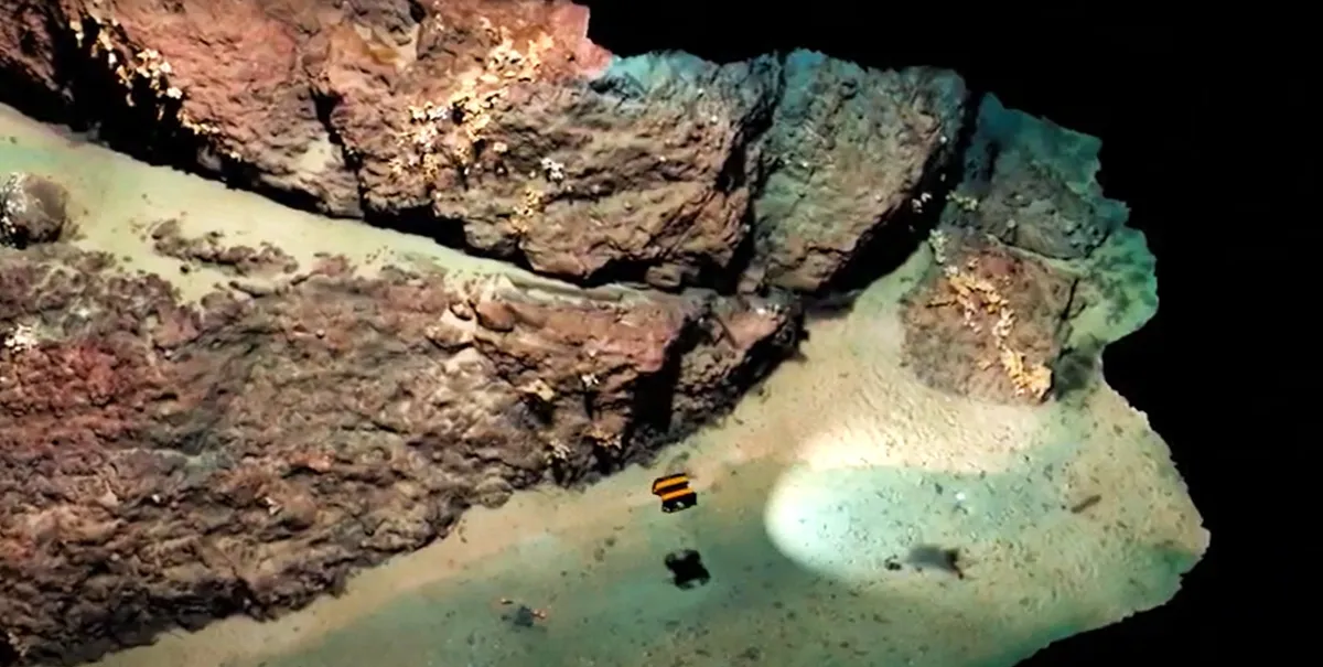
The experts in underwater imaging technology are trialling the first-of-its-kind system to test its effectiveness of using remotely operated vehicles (ROVs) to create digital twins of the seabed.
Over the next 12 months, the team at Tritonia, with additional support from the Lyell Centre, seafood producer Mowi, and the Sustainable Aquaculture Innovation Centre (SAIC), will develop a digital record of the hard substrate found at Mowi sites in the Western Isles using a technique known as georeferenced photogrammetry. Compared to soft seabed, where samples of sediment can be taken regularly and easily, monitoring hard substrates can be challenging because of the low visibility of the water even when using divers or drop-down cameras to assess the terrain. The hard nature of the seabed makes it near impossible to grab samples.
The new system will use underwater ROVs linked to above water GPS technology and acoustic transponders to capture digital images of the seabed to assess the seabed at current of future finfish farms as well as identifying the presence of priority marine features – nationally protected habitats and essential underwater ecosystems for Scotland's coastal seas. Using the images, Tritonia will create an accurate 3D model that can show various physical characteristics and be used alongside advanced comparison software to monitor changes on the seabed.
Dr Heidi Burdett, Associate Professor at the Lyell Centre, added: “Coastal habitats are some of the most physically and biologically diverse ecosystems on our planet. The socioeconomic, environmental and cultural benefits we gain from them are worth billions around the world every year. Monitoring the effect of coastal industry and human activity on these habitats is crucial for understanding how best to protect them, but it remains logistically difficult. This project will allow us to overcome this using a scalable and flexible approach that brings the seabed into a virtual laboratory.”
Martin Sayer, managing director of Tritonia Scientific, said: “Using imaging technology could help the aquaculture sector to gain a much more detailed, accurate picture of the complex seabeds they are operating beside or above. Our hope is that the system could ultimately support regulation and environmental monitoring in ways that would provide the levels of evidence that would be necessary for future sustainable operations."