Published:
Researchers from Heriot-Watt's School of Energy, Geoscience, Infrastructure and Society have found new evidence for when the Earth's strongest current began circulating around Antarctica. Their new report also warns that stronger winds caused by climate change could drive changes in the temperature of water around Antarctica and carbon release from the deep ocean.
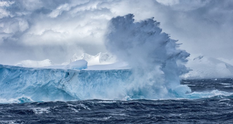
The Antarctic Circumpolar Current (ACC) moves 130-180 million cubic metres of water round the Southern Ocean every second, more than 100 times the flow of all the Earth's rivers combined. It keeps Antarctica cold and isolated from warmer oceans and seas, and also affects upwelling of water from the deep Southern Ocean, one of the largest repositories of carbon dioxide on the planet.
Dr Uisdean Nicholson and Professor Dorrik Stow from the Institute of Petroleum Engineering combined seismic surveys from offshore the Falkland Islands, and data from sediment cores extending several hundred metres below the seabed to calculate when the ACC began.
The scientists now know how the current changed over millions of years, and can use information from the past to predict how it will respond and contribute to climate change.
Dr Uisdean Nicholso said: “The Antarctic Circumpolar Current is a juggernaut of a current that has profound importance for Antarctica and the global climate.
“We now know it began around 34 million years ago. We know there was a sudden onset of very strong currents because we can see a phase of pronounced erosion in the deep ocean, and the formation of a giant deep-water sand sheet, which was transported and deposited by the current.
“This coincides with the time that major glaciers began to form in Antarctica, and is consistent with many scientists' belief that the thermal isolation of Antarctica by this current was fundamental to the onset of glaciation. So Antarctica didn't freeze solely because of decreasing C02 levels - the new current played a major role.
“At some point in the last million years, the currents decreased significantly. This was shortly after the time when we moved from a relatively warm climate, in the Pliocene, when there were trees at the South Pole and no major northern hemisphere glaciers, to the ice-house world of the Pleistocene, when the Earth has fluctuated between glacial and interglacial periods.
“Recent studies have shown us how currents in the Southern Ocean responded to and influenced climate change in the Pleistocene. Our study gives us some intriguing new evidence about conditions in the warm Pliocene, when CO2 levels last exceeded 400 parts per million - a level we have just exceeded because of greenhouse gas emissions. Understanding the oceanographic events of that era, and how they changed, will help us predict future changes and feedbacks between oceans and the atmosphere in a warming world.”
The new research, published in Scientific Reports today, also outlines how a stronger ACC could disrupt the carbon cycle.
Professor Dorrik Stow said: “Warmer air temperatures caused by higher atmospheric carbon dioxide will shift and strengthen the south-westerly winds that drive the ACC. This will change the dynamics of deep ocean currents and could result in upwelling of carbon dioxide from the deep ocean - which will, in itself, cause more global warming.
“It could also create more intense eddies - giant, 100-mile wide whirlpools that extend deep into the ocean - which could weaken the thermal isolation and increase the rapid melting of Antarctica. That is consistent with the pronounced erosion we see in the Falkland Plateau prior to the Pliestocene.
“There are a number of major scientific expeditions around Antarctica at the moment, which are trying to improve our understanding of these currents and their relationship to climate change. We must be better prepared for the changes that are already underway.”
Dr Nicholson and Professor Stow used data supplied by the Falkland Islands government. Seismic surveys covered an area of more than 50,000 km2 east of the Falkland Islands. Three geotechnical boreholes provided access to sediment data, which could be dated using microscopic organisms such as foraminifera and diatoms.
Read the full paper, Erosion and deposition beneath the Subantarctic Front since the Early Oligocene, here: https://www.nature.com/articles/s41598-019-45815-7